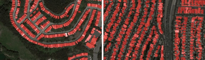
Satellite images semantic segmentation with deep learning
Building maps to fit a crisis situation provides a challenge even when considering the impact of satellite imaging on modern cartography. Machine learning significantly reduces the time required to prepare an accurate map.
Copy and paste this URL into your WordPress site to embed
Copy and paste this code into your site to embed