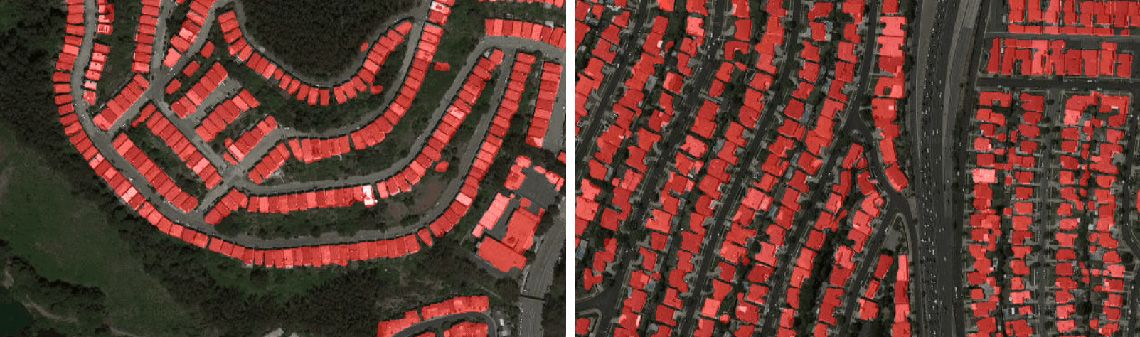
Satellite images semantic segmentation with deep learning
Building maps to fit a crisis situation provides a challenge even when considering the impact of satellite imaging on modern cartography. Machine learning significantly reduces the time required to prepare an accurate map.